When thinking about wildfires in California, many of us picture the large forested areas in the north. However, Los Angeles County experiences a very different kind of wildfire challenge — and getting to know what makes LA particularly vulnerable is the first step on our journey toward building resilience.
The Stakes Are High
In January 2025, a series of catastrophic wildfires swept across Los Angeles and surrounding counties. Fueled by extreme Santa Ana winds, low humidity, and hot, dry fuels, the fires destroyed thousands of structures and led to massive evacuations.
Those events weren’t anomalies — they’re symptomatic of a shifting baseline. The LA County Climate Vulnerability Assessment and the City of Los Angeles Community Wildfire Protection Plan both identify wildfire as a growing hazard, particularly in hillsides and urban-edge zones.
According to county hazard assessments, Los Angeles County contains hundreds of square miles in Very High Fire Hazard Severity Zones (VHFHSZ), especially in Local Responsibility Areas (LRAs) and State Responsibility Areas (SRAs).
Understanding how vulnerability builds helps communities and residents act more effectively.
The Three Drivers of Wildfire Vulnerability in LA
1) Fuels & Vegetation
Los Angeles isn’t a forest. The fires here run through chaparral, coastal sage shrub, grasses, and highly flammable brush, not giant conifers and forest duff. In fact, post-fire analyses of the January 2025 events found that shrubland ecosystems accounted for 57.4–75.8% of burned area.
Invasive grasses and non-native plants fill in gaps that, once cured, act like continuous tinder — linking shrub patches and making fire spread quickly across slopes and into neighborhoods.
LA County’s Vegetation Management Program (in place since 1979) explicitly recognizes that fuel type, moisture, continuity, slope, and aspect all influence fire behavior.
2) Ignition Pressure
In LA, almost all major wildfires are human-caused — from power line strikes, equipment failures, vehicles, construction, and sometimes intentional acts. With dense development adjacent to wildland zones, the margin for ignition is thin.
Because many homes, roads, and utilities lie close to brush and canyon vegetation, a small spark at the edge of a neighborhood can escalate rapidly under the right conditions.
3) Topography & Weather
Canyon drainages and mountainous terrain cut Los Angeles. The north–south canyon systems serve as fire corridors, channeling winds and drying vegetation.
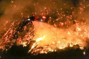
When Santa Ana winds blow, they push hot, dry air downhill, drop humidity, and drive embers ahead of the flame front. The 2025 fires in LA were driven in part by winds exceeding 100 mph in some areas.
Slope and aspect intensify the fire: uphill fire spread is faster, and south- or west-facing slopes in LA typically dry out more rapidly.
A Changing Risk Landscape
Climate shifts have made fire conditions more severe. The City’s wildfire protection plan notes that rising temperatures, extended drought, and changing precipitation patterns convert vegetation into more combustible fuel over longer windows.
New Hazard Maps & Growing Zones
CAL FIRE’s updated fire hazard maps have expanded “Very High” zones in LA, adding neighborhoods farther from steep hillsides, such as areas north and south of the Santa Monica Mountains and parts of Glendale.
Many newly designated zones trigger stricter building standards and brush clearance requirements — putting pressure on homeowners and local governments.
The 2025 Fires as a Wake-Up Call
In that January event record, the Palisades Fire alone destroyed over 6,800 structures — making it the most destructive in LA’s history.
The structural losses in urban-interface zones (like Eaton Fire in Altadena and Palisades) dwarfed rural fires in 2025 — reflecting how severe exposure becomes when fire meets dense development.
Community & Infrastructure Exposure
Some of the neighborhoods most at risk include Hollywood Hills, Brentwood, the Sepulveda Pass, Pacific Palisades, and steep canyon enclaves like Mount Washington. These are typically within or adjacent to Very High Fire Hazard Severity Zones.
Infrastructure and evacuation pose extra challenges:
- Narrow canyon roads can clog during evacuations,
- Shelters may be distant or undersized, and
- Fire scars can create secondary hazards like landslides and flooding after rain.
A recent study of the 2025 Palisades and Eaton fires also highlights inequities in fire shelter accessibility, particularly in isolated and mountainous areas.
Social vulnerability matters too. Communities with older populations, lower incomes, or limited mobility may face greater risk during an evacuation or fire event.
What Can Be Done (and What Residents Must Do)
- Maintain defensible space and keep brush clear around structures
- Use fire-resistant construction materials, screen vents and eaves
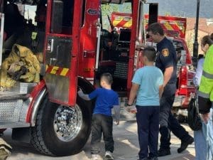
- Create Firewise USA divisions in hillside neighborhoods, working with MySafe:LA
Ignition Reduction & Community Planning
- Enforce safe practices for clearing equipment, vehicles, power lines
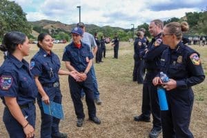
- Plan evacuations, coordinate with agencies, run SET – GO drills
Local Funding & Adapted Grant Programs
- Advocate for wildfire grants that recognize Southern California’s fuel types
- Prioritize outcomes (reduced ignitions, community protection) over acres treated
Monitoring & Awareness
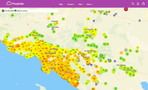
- Use local RAWS (Remote Automated Weather Stations) and live fuel moisture data
- Track Santa Ana outlooks and Red Flag Warnings
- Educate residents where fire is most likely to start and spread
Turning Understanding into Action
Los Angeles’s wildfire risk is unique — not forest fires, but fast-moving brush, wind-driven flame, and tight margins between fire and home. The vulnerability lies in the interplay of fuels, ignition pressure, and topology.
But knowledge is power. When residents, planners, and agencies understand where the risk is most significant and why, they can act strategically — harden homes, clear fuels, secure ignition sources, and prepare for evacuation.