Wildfire Los Angeles

Understanding the threat from Wildfire

California is Burning

Many people in California understand that our wildfire “season” is now year-round. Wildfire is a growing threat to anyone living in a canyon or mountainous area, especially if you live in what is called the Very High Fire Severity Zone, or VHFSV. What many people may not understand is how the risk applies to them – or put another way: to you. Being a part of the Wildfire Alliance and the MySafe:LA Fire Safe Council are important steps in being better prepared against the threat from wildfires.

The Numbers on Wildfire

Three California counties consistently rank among the highest in the U.S. for wildfire hazard exposure:

  • Los Angeles County is essentially 100% in high or very high Fire Hazard Severity Zones (FHSZ), reflecting comprehensive coverage across both Local (LRA) and State Responsibility Areas (SRA) mapped by CAL FIRE.

  • San Bernardino County and Riverside County are similarly classified at the upper tiers of wildfire risk across multiple datasets, with most built areas falling within high or very high zones.

FEMA National Risk Index

The FEMA National Risk Index (NRI) provides downloadable county and census tract-level wildfire exposure data, including metrics such as:
  • Annualized wildfire frequency
  • Housing value and number of structures exposed
  • Expected annual loss and social vulnerability factors
This tabular and GIS data is available via FEMA’s hazard data portal and can be used for modeling risk exposure and structure counts at scale. By combining FEMA NRI with CAL FIRE’s FHSZ boundaries, you can compute precise counts of properties or structures at risk for specific geographies—e.g. Los Angeles County, ZIP code, or Census tract.

CAL FIRE Fire Hazard Severity Zones (FHSZ)

CAL FIRE provides spatial mapping of ModerateHigh, and Very High wildfire hazard zones through publicly available GIS layers. For Los Angeles County, both Local Responsibility Area (LRA) and State Responsibility Area (SRA) FHSZ data are available in ArcGIS feature services and data portals. By overlaying FEMA’s tract-level exposure data with CAL FIRE’s FHSZ spatial layers, you can calculate:
  • Number/percentage of structures per tract within high-hazard zones

  • FEMA-rated loss or exposure for those structures

  • Demographic overlays for equity-focused targeting

State Responsibility Area (SRA) maps became effective on April 1, 2024, covering wildland areas under state fire protection jurisdiction.

Local Responsibility Area (LRA) maps—reflecting city and county lands—are being rolled out in phases during early 2025; for Los Angeles County, they include updated recommendations from local jurisdictions released during February through March 2025, with formal adoption expected within 120 days of release.
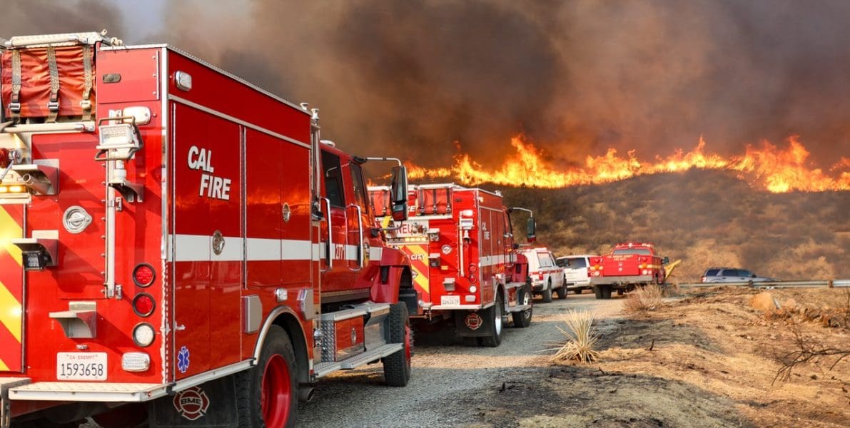
These maps are essential for understanding which parcels fall into high-hazard zones, informing building codes (e.g. Chapter 7A), defensible space regulations (PRC 4291), and wildfire prevention strategies.
wildfire-threats Large

A Community Plan for Los Angeles

MySafe:LA is authoring a Community Wildfire Protection Plan for the City of Los Angeles. This plan, funded in part by FEMA, is a strategic document that is designed to provide the community with an understanding of the risks related to wildfires, the resources that respond to them, and to identify projects and solutions for reducing risk over time. MySafe:LA is working with an array of subject matter experts including but not limited to the U.S. Forest Service, CAL FIRE, CalOES, mulitple L.A. City departments (including the LAFD and EMD), as well as wildfire experts. Public engagement meetings were held over a nine-month period of time and a survey was also made available to the public. The plan will be available in the near future. 

Thanks for letting us know!

We look forward to seeing you there!

Register to be a Recovery Volunteer

We’re glad you’re here! We’d like to hear from you if you’d be interested in volunteering to help recovery efforts following the tragic series of wildfires that affected Los Angeles. Volunteers will only be used for recovery once fire dangers are resolved. By registering, you are permitting us to ask if you’d be interested in supporting the recovery effort. There is no guarantee that your name will be called. If we do call your name, you are under no obligation to volunteer and may decline or accept any offer.

Say Thanks to Firefighters, Police, and Other Responders!

Please add your name and message to the firefighters who responded to the wildfires in Los Angeles in January 2025. Let them know how much you appreciate their sacrifices to attack the unparalleled wildfires that destroyed thousands of homes. This was a “once-in-a-century” wind and wildfire storm, and these brave men and women deserve to hear from us.

Thank you for all your efforts in battling the life-threatening and disastrous wildfires that struck the Los Angeles area this January. We are grateful for your devotion to saving lives.

Need to register? Start here!